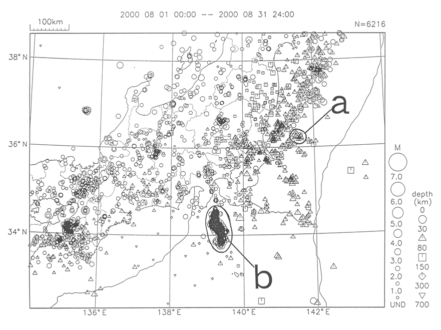
Kanto-Chubu Region
a) In the sea off Ibaraki Prefecture, there was an M4.6 event on August 18th, and an M5.4 event on August 19th in association with the subduction of the Pacific Plate.
b) There has been a high level of seismic activity in the area from Miyakejima to Niijima-Kodushima, with an M6.0 event (maximum seismic intensity 6 lower) east of Kodushima on August 18th, and an M4.9 event (maximum seismic intensity 6 lower) southwest of Shikinejima. Also, the period of August 4-5 saw an increase in the level of activity with a total of three events of maximum seismic intensity 5 lower (maximum M4.5) recorded. On August 16th, there was an M4.9 event (maximum seismic intensity 5 lower), and again on August 29th there was an M4.9 event (maximum seismic intensity 5 lower).
Additionally, although it occurred outside the area under discussion, on August 6th there was a deep M7.3 event (maximum seismic intensity 4 and at a depth of 430 km) in the sea near Torishima. Also, on August 28th, there was an M6.2 event in the sea 600 km south-southeast of Chichijima [the sea near Chichijima]. There was an M7.6 event on March 28th in the same area.
Furthermore, on September 9th, there was an M4.2 event (maximum seismic intensity 3) in eastern Saitama Prefecture. On September 11th, there was an M5.3 event (maximum seismic intensity 5 lower) to the west of Toshima [the sea near Niijima-Kozushima].
Note: Within square brackets ([ ]) is the epicenter place name used by the Meteorological Agency in its information releases.
Note:
M=magnitude
N: total number of events in the figure
depth=depth of hypocenter
UND=Earthquakes of less than M1.0 and earthquakes whose magnitude was not recorded.
The key to the symbols shows on the left the size of an earthquake and on the right the depth of the hypocenter.

Japan Meteorological Agency,Science and Technology Agency