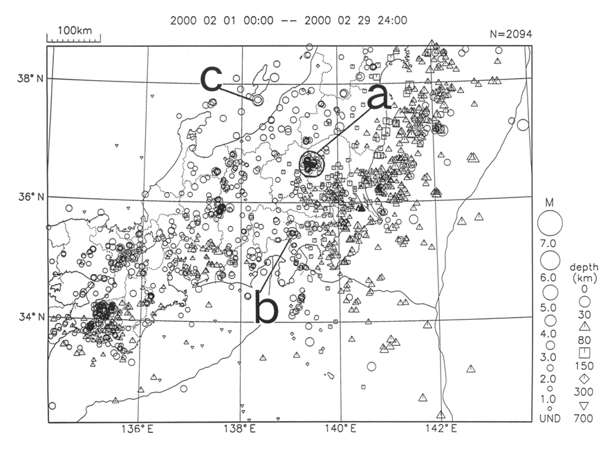
Kanto-Chubu Region
a) There was clustered seismic activity, with a maximum M4.1 earthquake on 6 February, at the border of Tochigi and Gumma Prefs. [Northern Tochigi Prefecture] (maximum intensity: 4).
b) An M4.2 earthquake occurred on 11 February at the border of Yamanashi and Kanagawa Prefs. [Eastern Yamanashi Prefecture] (maximum intensity: 3).
c) An M4.3 earthquake occurred on 29 February offshore of Niigata Pref. (maximum intensity: 3).
Note: Within square brackets ([ ]) is the epicenter place name used by the Meteorological Agency in its information releases.
Note:
M=magnitude
N: total number of events in the figure
depth=depth of hypocenter
UND=Earthquakes of less than M1.0 and earthquakes whose magnitude was not recorded.
The key to the symbols shows on the left the size of an earthquake and on the right the depth of the hypocenter.

Japan Meteorological Agency,Science and Technology Agency